
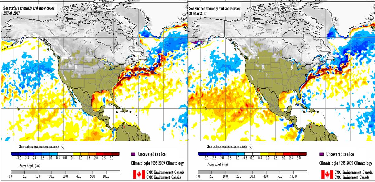
RALEIGH — The sea surface temperature trends we mentioned last week in the Eastern Pacific that we expect on the long term to help push the weather patterns in the forecast region towards warmer and somewhat drier conditions are continuing. So there is now less uncertainty in our forecast that we will see for the most part normal to slightly above normal temperatures for the near, mid range and long term outlooks. We currently expect that the wetter than normal conditions will tend to be with us until at least early April. We then expect there will be a tendency for more normal precipitation and even drier than normal condition as we get into late spring early summer.
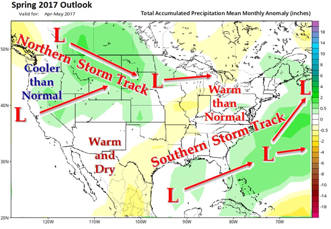
The sea surface temperature warming and resulting anomalies taking place in the Eastern Pacific are now starting to looks more like an “El Nino” sea surface temperature pattern which tends to promote a the southern storm track and wetter than normal conditions from NC southward. We are now seeing observed and forecast evidence of the southern storm track strengthening.
The snow depth charts are now showing a significant reduction in snow cover in the upper Great Plains now extending into Canada. However, the snow cover is only slowly melting in the Northeast US and Eastern Canada. The overall reduction in snow pack will likely allow warmer temperatures to develop in the middle part of the country that we still expect to move east and keep temperatures generally near to above normal in the forecast regions as we near the end of March and lasting well into April.
But the snow cover in the Northeast provides the risk of an unexpected surge of cold air into the eastern third of the US if a low pressure system were to develop along the East Coast and be stronger and move further north than we currently expect. If a storm were to be stronger and further north along the East Coast US than expected, the wind circulation of a low pressure system could tap into the cold air and cause a currently un-forecasted cold snap. We don’t see this happening at this time, but there is a moderate risk of a currently un-forecasted cold snap event occurring over the next month.
Highlights:
29 Mar – 31 Mar (Wed – Fri): Temperatures warm to above normal, cool to near normal late; widespread rain showers likely mid-late in the period.
01 Apr – 03 Apr (Sat – Mon): Temperatures start near to slightly below normal then warm to slightly above normal; scattered rain shower far northern section early in period.
04 Apr – 06 Apr (Tue – Thur): Temperatures slightly above normal; scattered rain showers southern sections, steady rains northern sections entire period.
07 Apr – 09 Apr (Fri – Palm Sunday) Temperatures stay near normal; Steady rains southern half of region mid to late in the period. This will cause a large area of rain from the NC area and south, with only widely scattered showers north of NC from mid to late in the period.
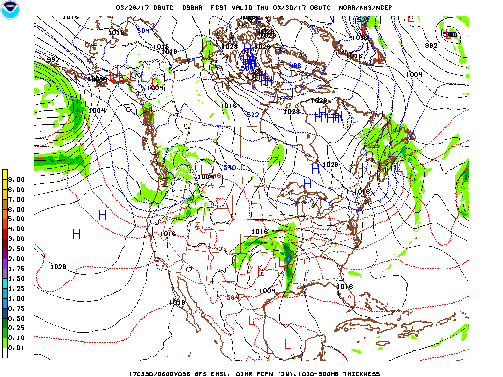
Forecast discussion day 3 – 5 (29 Mar – 31 Mar) Temperatures warm to above normal, cool to near normal late; widespread rain showers likely mid-late in the period. Expect a low pressure system to form in the lower Mississippi River Valley and move east-northeast into and through the forecast area by mid to late in the period. This will allow for temperatures to be 5-10 F above normal early-mid period then fall back to near normal by late in the period. Expect widespread rain showers to develop by mid-late in the period moving from the southwest to northeast through the forecast region. Expect high temperatures to range from the upper 50s in the north to upper 70s in the south. Low temperatures ranging from the low 30s to low 50s. Precipitation amounts will likely be in the 0.30 – 0.60” range.
Climatology:
| Station | High T | Low T | Station | High T | Low T | |
| Charlottesville VA | 65 | 42 | Greensboro NC | 67 | 44 | |
| Richmond VA | 66 | 43 | Asheville, NC | 64 | 42 | |
| Roanoke VA | 64 | 42 | Charlotte, NC | 68 | 44 | |
| Hillsville VA | 59 | 34 | Fayetteville, NC | 69 | 44 | |
| Salisbury, MD | 58 | 33 | Aberdeen, MD | 55 | 36 |
Forecast discussion day 6 – 8: (01 Apr – 03 Apr) Temperatures start near to slightly below normal then warm to slightly above normal; scattered rain shower far northern section early in period. Expect the previously mentioned low pressure system to move east-northeast out to sea early in the period. As the low moves off-shore it will cause some light scattered showers in the far northern sections of the forecast region and slightly cooler temperatures in the northwest flow behind (west of) the low. A weak but warm high pressure system moves into the region by mid period keeping the weather dry and warming the temperatures to slightly above normal mid-late in the period. Expect temperatures to be near the seasonal norm early and then to rise to slightly above average by mid to late in the period. Expect high temperatures to range from the upper 50s in the north to upper 70s in the south. Low temperatures ranging from the low 40s to low 50s. Precipitation amounts will likely be in the 0.05 – 0.15” range southern section and near zero in the northern sections.
Climatology:
| Station | High T | Low T | Station | High T | Low T | |
| Charlottesville VA | 67 | 44 | Greensboro NC | 68 | 45 | |
| Richmond VA | 68 | 44 | Asheville, NC | 65 | 43 | |
| Roanoke VA | 66 | 43 | Charlotte, NC | 70 | 45 | |
| Hillsville VA | 62 | 34 | Fayetteville, NC | 71 | 45 | |
| Salisbury, MD | 64 | 42 | Aberdeen, MD | 63 | 42 |
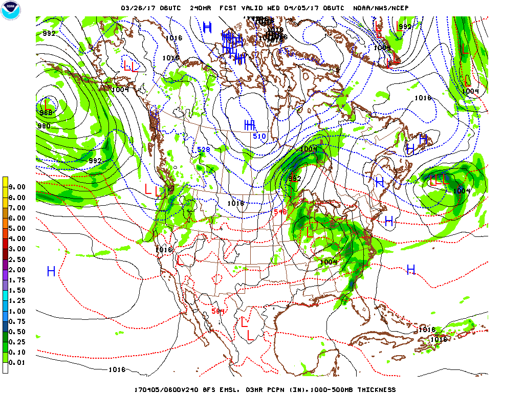
Forecast discussion day 9 – 11: (04 Apr – 06 Apr) Temperatures slightly above normal; scattered rain showers southern sections, steady rains northern sections entire period. High pressure system will slowly move east of the region as a low pressure system forms in the mid-Mississippi River Valley and moves northeast with the center of the system passing just north and west of forecast region. This will allow for near seasonable to slightly above seasonal temperatures and rain to develop by early in the period. Expect the precipitation to be more of a steady rain from the NC region north and more showers with isolated thunderstorms south of NC. Expect a slight cooling trend after the low moves north and east of the region, so expect temperatures to be near average by late in the period. Expect temperatures to be near the seasonal norm early and then to warm to slightly above average by mid to late in the period. Expect high temperatures to range from the upper 50s in the far north to mid 70s in the south. Low temperatures ranging from the low 40s to low 50s. Precipitation amounts will likely be in the 0.50 – 1.00” range.
Climatology:
| Station | High T | Low T | Station | High T | Low T | |
| Charlottesville VA | 69 | 46 | Greensboro NC | 70 | 47 | |
| Richmond VA | 70 | 46 | Asheville, NC | 67 | 45 | |
| Roanoke VA | 68 | 45 | Charlotte, NC | 72 | 47 | |
| Hillsville VA | 64 | 36 | Fayetteville, NC | 73 | 47 | |
| Salisbury, MD | 66 | 44 | Aberdeen, MD | 65 | 43 |
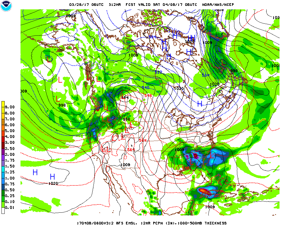
Forecast discussion day 12 – 14: (07 Apr – 09 Apr) Temperatures stay near normal; Steady rains southern half of region mid to late in the period. Expect another low pressure system to form in the mid-Mississippi River Valley, but this time expect it to move east-southeast through the southern portions of forecast area by mid to late in the period. This will cause a large area of rain from the NC area and south, with only widely scattered showers north of NC from mid to late in the period. Expect high temperatures to range from the low 60s in the north to low 70s in the south. Low temperatures ranging from the low 40s to low 50s. Precipitation amounts will likely be in the 0.50 – 1.00” range southern half and in the 0.00 – 0.15” range in the northern half of the region.
Climatology:
| Station | High T | Low T | Station | High T | Low T | |
| Charlottesville VA | 71 | 48 | Greensboro NC | 72 | 49 | |
| Richmond VA | 72 | 48 | Asheville, NC | 69 | 47 | |
| Roanoke VA | 70 | 47 | Charlotte, NC | 74 | 49 | |
| Hillsville VA | 66 | 38 | Fayetteville, NC | 75 | 49 | |
| Salisbury, MD | 68 | 46 | Aberdeen, MD | 67 | 45 |
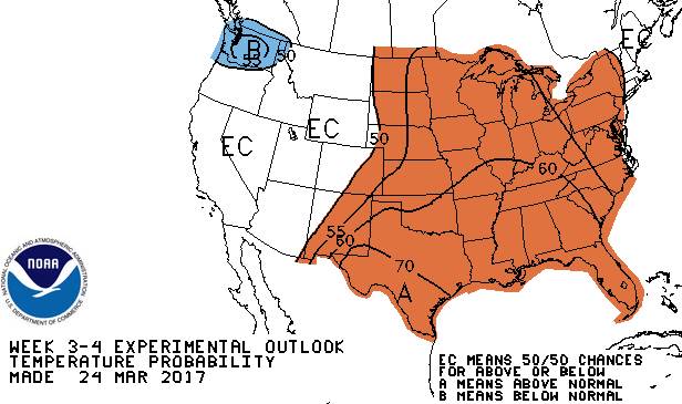
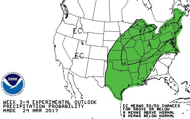
Day 15 – 30 Temperature Outlook 10 Apr – 25 Apr
Day 15 – 30 Precipitation Outlook 10 Apr – 25 Apr
Outlook discussion day 15 – 22: (10 Apr – 17 Apr) Early indications are that temperatures and precipitation will be above the seasonal average during this period.
Outlook discussion day 23 – 30: (18 Apr – 25 Apr) Early indications are that temperatures will be slightly above the seasonal average and precipitation will be near the seasonal average during this period.
| General Seasonal Outlook Apr – May 2017 | |
| The long term atmospheric signals are still mixed in terms of forcing either colder or warmer conditions over the next two months. But there are some subtle sea surface temperature trends in the Eastern Pacific that we expect will help push the weather patterns in the strawberry forecast region towards warm and somewhat drier conditions. So we expect the temperature for the forecast region to be generally warmer than normal with precipitation close to normal for the period April-May 2017. The indications are that there will be two moderately active storm tracks. A northern track off of the Pacific with two branches that will tend to converge and weaken in the upper Mississippi River Valley and a southern track that moves out of the Gulf region. The southern track will see most storms go out to sea, but a few will head up the coast into New England. |
— Dr. Barclay Poling, Former Professor and Extension Specialist, Strawberries and Muscadines, Horticultural Science – NC State University
For more news from North Carolina, click here.
RECOMMENDED ARTICLES

ATHENS, Ga. — Corn production for grain in the United States is forecast at 13.9 billion bushels, up slightly from the previous forecast but down 8 percent from 2021. Based on conditions as of November 1, yields are expected to average 172.3 bushels per harvested acre, up 0.4 bushel from the previous forecast but down […]

LAKEWOOD, Colo. — Based on August 1 conditions, corn production in Colorado is forecast at 142.78 million bushels, according to the August 1 Agricultural Yield Survey conducted by the Mountain Regional Field Office of the National Agricultural Statistics Service, USDA. This forecast is down 4 percent from last year’s 148.35 million bushels. The 1.21 million […]